General Information
Національний природний парк «Нижньодніпровський» розташований на території Бериславського, Білозерського, Голопристанського та Цюрупинського районів, міст Херсона та Нової Каховки Херсонської області. Його площа становить 80177,80 га у тому числі 14479,80 гектара земель, що надаються національному природному парку в постійне користування з вилученням у землекористувачів, та 65698,00 гектара земель, що належать до його території без вилучення.
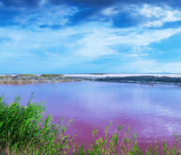
The territory of the park covers a large part of the lower reaches of the Dnieper with adjacent territories from the Kakhovka hydroelectric station to the Dnipro estuary is one of the most valuable flood-littoral objects in Europe. The national park stretches from north-west to south-east almost 120 km, from the dam of the Kakhovka hydroelectric station to the border of Kherson and Mykolaiv regions (passing on the left bank near the village of Heroyske, and on the right bank - along Oleksandrivka); The width of the object varies from 3 to 7 km.
Main features of the park:
Територія національного природного парку «Нижньодніпровський» розташована в континентальній області кліматичної зони помірних широт і характеризується помірно-континентальним кліматом з м’якою малосніжною зимою та спекотним посушливим літом. Найнижча температура в області спостерігається в січні. Середньомісячна температура січня становить на півночі – 4,5 °С, в центрі – 3,5-4 °С, на півдні – 3 °С. Починаючи з березня, температура повітря на фоні частих знижень починає зростати, спочатку поступово, потім більш інтенсивно, особливо в квітні. Найтепліший місяць – липень. Температура повітря в липні від +22°С на північному заході до + 23 °С на більшості території. Максимальна температура + 40 °С. Восени спостерігається поступовий спад температури повітря.
In total, 53 types of vascular plants that are subject to protection are registered in the park, including (107 items in various lists), in particular:
- Anacamptis palustris - The species is listed in the Red Data Book of Ukraine as "Vulnerable". Decorative, medicinal culture. In addition to the Red Data Book of Ukraine, the species is listed in the Red Book of Italy, Russia, the Protected List of Belgium, the Annex to the Convention on International Trade in Endangered Species of Wild Fauna and Flora (CITES). Throughout the range there is a decrease in the number.
- Dactylorhiza incarnata – Environmental protection status of the species: Vulnerable. The reasons for changing the number are drainage, land development, intensive grazing, overgrown meadows.
- Water Chestnut - Environmental protection status of the species: Not Vulnerable. The reason for changing the number is meliorative work, drying or salinization of reservoirs, pollution of reservoirs, destruction of plants during the collection of fruits. It is forbidden to break down growth areas and harvest nuts.
- Bouillon Tulip - a rare perennial plant entered in the Red Book of Ukraine in the status of "Vulnerable". The causes of the change in size are the disturbance and transformation of natural ecotopes as a result of economic development of territories: construction, plowing of the steppe massifs, artificial afforestation, grazing of cattle, trampling in places of recreation, gathering plants on bouquets, excavation of bulbs.
he fauna of this territory is also rich. Here you can find birds such as octopus martin, white-tailed eagle, steppe serpent, mammoth wasp, swallowtail, and so on.
Water tourist route "Dniprovska Gilea"
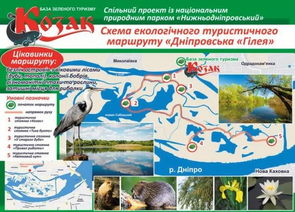
The total length of route №77-1 is 9 km. On the route, visitors can get acquainted with natural attractions:
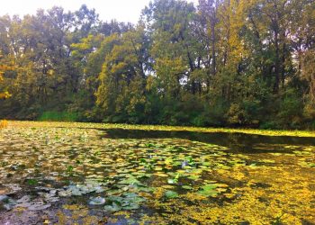
- groups of flowering water lilies in the smooth lakes
- «Дніпровськими джунглями» – лісовими насадженнями на плавневих островах;
- places of "work" of beavers
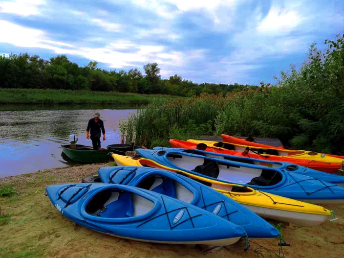
Маршрут розпочинається на території бази зеленого туризму «Козак» (с. Одрадокамʼянка, Бериславського району), де розміщений інформаційний стенд – картосхема розробленого маршруту, встановлені інформаційні, підтверджувальні та вказівні знаки.
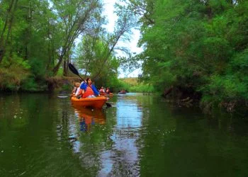
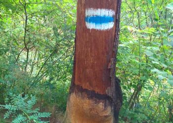
After conducting the tour, the tourists sit down in their Canadian kayaks "Pelican", and start their exciting route, which is marked by a sign.
Starting a trip by the river Cossack, we pay attention to the designation of the route

,

, пропливши приблизно 1.5км, повертаємо байдарки ліворуч до річки Хмельник по якій ми рухаємося близько 2.2 км, та наближаємося до острова – пішохідної переправи, який за сумісництвом є місцем для відпочинку та знайомства з його господарями бобрами, які є справжніми інженерами. Тварини з фантастичною швидкістю орудують своїми зубами і за 2-3 хвилини можуть перегризти дерево товщиною 12-15см.
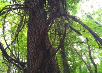
Plunging into the depths of the island, in front of the eyes of the audience there is an amazing, not typical of this area, the landscape, which visitors called the "Dnieper jungle".
The whole island is marked with appropriate signs, so it is impossible to get lost there.
Bypassing the island, tourists go to the Gnilovid River, where many blooming water lilies fall into the water.
Travelers are moving by the river Gnilovid through the reservoir of Sabetsky about 3.8km.
Having reached the Cossack River, tourists overcome their last 1.5 km journey, returning to the same base, where they end up with their emotional journey, which takes 5-6 hours.
Контакти | Голопристаньский район
Head: Попов Геннадій Васильович
Phone: (05539) 26-5-63
Website: